GRSF KB modeling
- Table of contents
- GRSF KB modeling
- Stock - identifier and name
- Stock - species
- Stock - water areas
- Stock - exploiting fisheries
- Stock - assessment and assessment method
- Stock - source of information
- Stock - state and exploitation rate
- Stock - abundance level
- Fisheries - name and identifier
- Fisheries - water areas
- Fisheries - management entity and jurisdiction area
- Fisheries - production system type, flag state and gear
- Fisheries - catches and landings
The GRSF KB will be constructed as a semantic warehouse using semantic web technologies. For achieving the desired data integration, we will use a variety of vocabularies and top level ontologies for modeling the concepts of the various sources. Just indicatively we will use (and extend if needed) some of the following models/ontologies/vocabularies CIDOC CRM (http://www.cidoc-crm.org/), CRM Extensions (www.ics.forth.gr/isl/CRMext), MarineTLO (www.ics.forth.gr/isl/MarineTLO/), Dublin Core (http://dublincore.org/), etc.
In the following we discuss how the various concepts will be modeled. More specifically we show how the most important concepts - as they are described as requirements in the GRSF overview wiki page - are modeled using the adopted semantic models. In the following figures we use rectangles to show the classes and the corresponding instantiations, and arrows to illustrate the properties between them. To improve the readability of the diagrams we replaced the namespace declarations classes and properties, with an abbreviation; more specifically crm refers to CIDOC CRM ontology while mtlo refers to MarineTLO ontology.
Stock - identifier and name
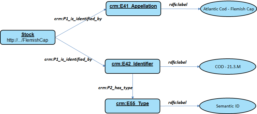
We expect to have several identifiers for stocks (Semantic IDs, UUIDs, etc.), therefore we want to support different types of identifiers. As regards the stock name it is derived by concatenating the species name with the water area name.
Stock - species
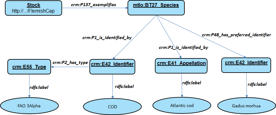
The species of a stock are modeled as specific instances of the corresponding class (derived from MarineTLO), and we also capture their scientific and common names as well as their code (i.e. FAO 3Alpha species code).
Stock - water areas
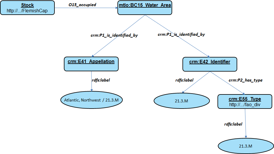
The water area of a stock is modeled as specific instance of the corresponding class (derived from MarineTLO), and we also capture information about the area (i.e. name, identity, etc.)
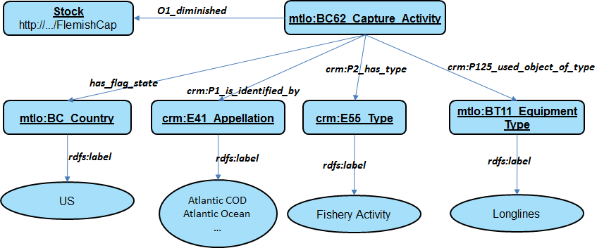
Stock - exploiting fisheries
In the diagram below we show how a fisheries activity is connected with a stock.
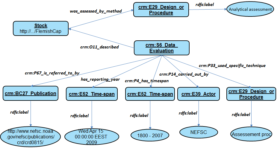
Stock - assessment and assessment method
Information about the stock assessment and the assessment method
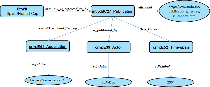
Stock - source of information
It contains all the bibliographic references which are related to the stock
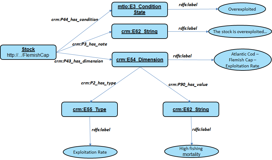
Stock - state and exploitation rate
It describes the state of the stock (in a formal and narrative form) and information about the exploitation rate
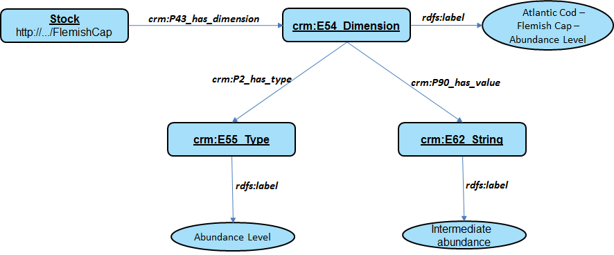
Stock - abundance level
Information about the abundance level of a stock
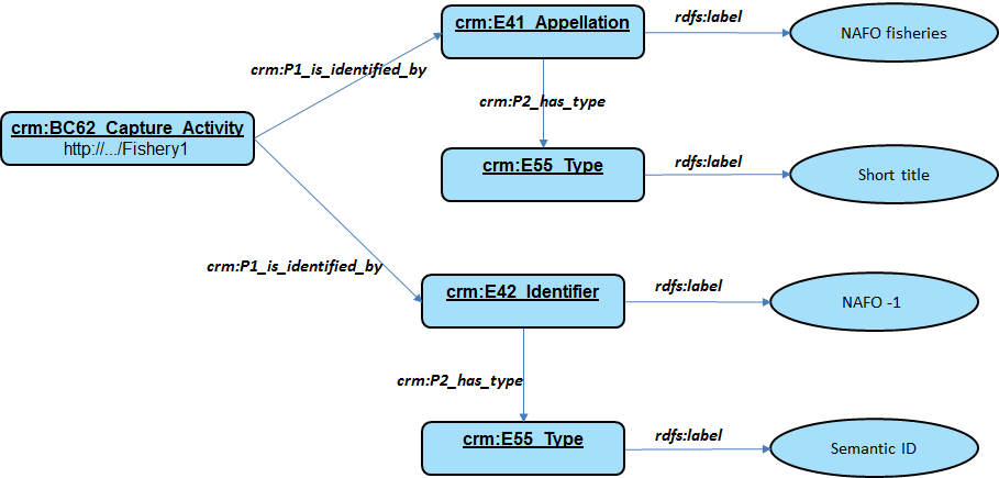
Fisheries - name and identifier
Similarly to the identifiers of stocks we support different types of identifiers (i.e. semantic ID, UUID, etc.) as well as different types of names/titles.
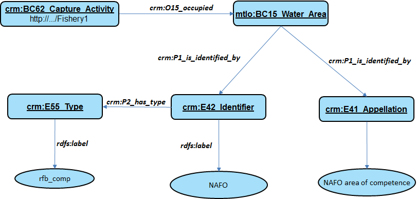
Fisheries - water areas
The following diagram shows how the fishery is connected with the different water areas it operates on
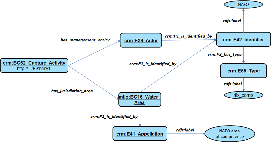
Fisheries - management entity and jurisdiction area
The diagram shows information about the management entity of a fishery and its jurisdiction area
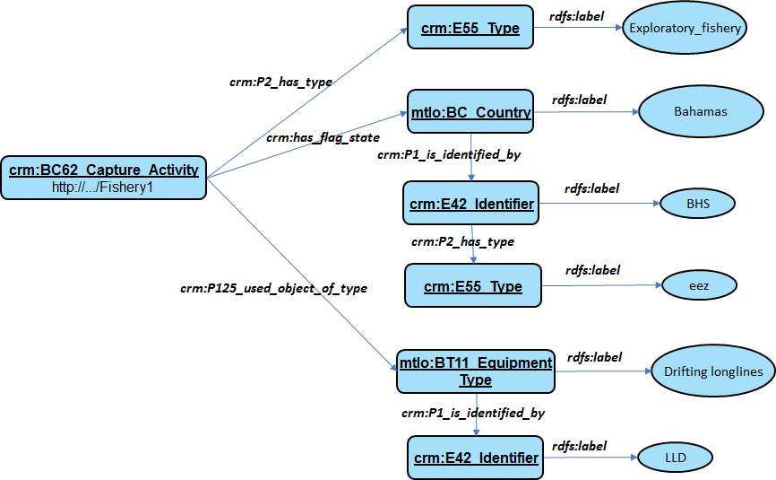
Fisheries - production system type, flag state and gear
The following diagram shows how information about the production system type, the flag state and the fishing gear are modeled and connected to the corresponding fishery activity.
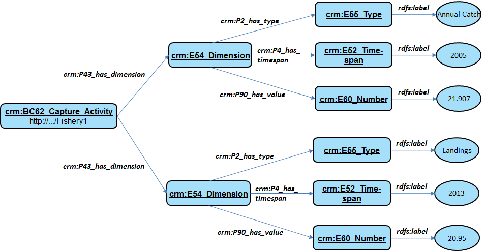
Fisheries - catches and landings
The diagram shows information about catches and landings of the fishery