Task #1120
closed
Conversion to geometry
100%
Description
The assignement of a CWP polygon to a point does not work or is not clear.
We would like to have a function where we make this mapping to polygons and not only points.
We want to have the same functionality for EEZ and FAO areas, ICES areas, etc. (where we have a layer)
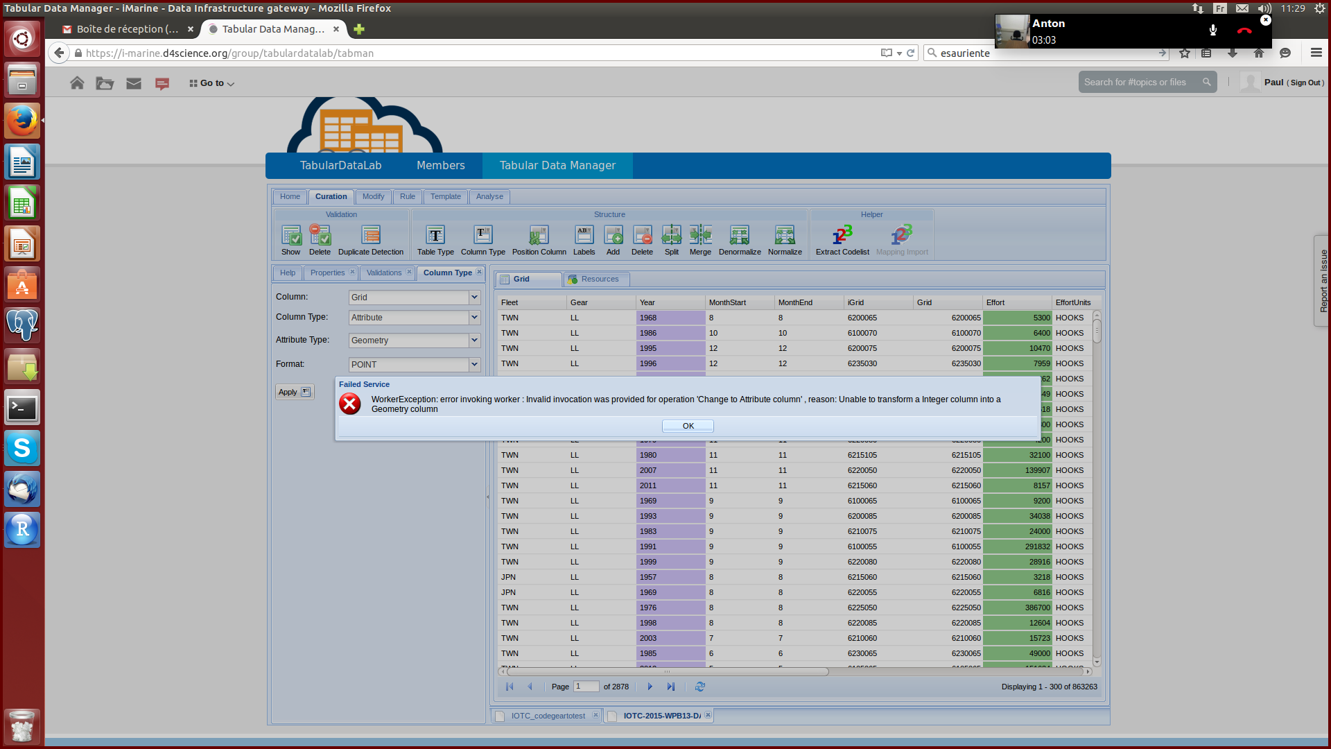
The error message is unclear
Files
 Updated by Lucio Lelii over 10 years ago
Which is the column that you are trying to convert to geometry?
 Updated by Paul Taconet over 10 years ago
A column in the CWP format, as described here: http://www.fao.org/fishery/cwp/handbook/G/en in the "Coding of graticule system for identifying statistical quadrangles" section
In my screenshot, it is the "Grid" column
Updated by Lucio Lelii over 10 years ago
I have discussed with @gianpaolo.coro@isti.cnr.it about this enhancement.
We decided to release an algorithm in StatMan for CWP format conversion to polygons and then to integrate it in TabMan as specific functionality.
This new feature will be ready in the next release (4.0.0).
For FaoArea and EEZ we could add this conversion using specific codelist for the mapping, what do you think about this?
 Updated by Pasquale Pagano over 10 years ago
- Tracker changed from Support to Task
- Status changed from New to In Progress
Please either comment or close this request.
Updated by Lucio Lelii about 7 years ago
- Status changed from In Progress to Closed

